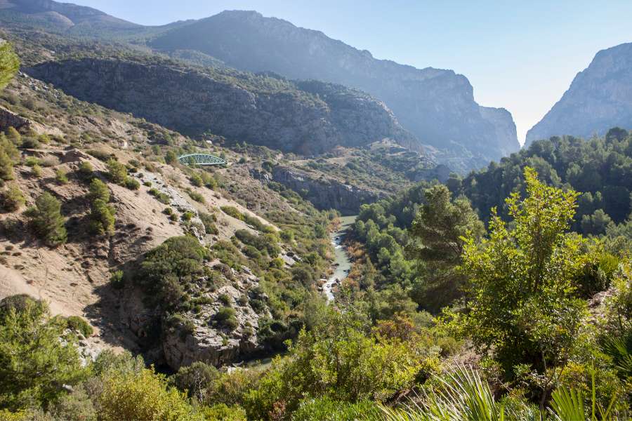
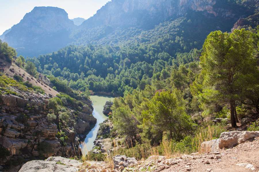
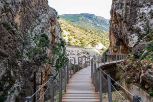
The Gaitanes Gorge stands as an impressive natural monument carved by the waters of the Guadalhorce River in the province of Malaga, in the warm region of Andalusia, Spain. This canyon, located between the municipalities of Ardales, Antequera, Campillos y Álora, offers an imposing landscape full of history that captivates visitors from all over the world. It is accessed from the north through the Guadalhorce reservoirs and from the south, through the picturesque village of El Chorro. In its narrowest sections, the gorge It narrows to just 10 meters wide, while its impressive walls rise to more than 400 meters high, creating a unique visual and emotional experience for those who venture to explore it.
Declared a natural site by Law 2/1989, of July 18, the Gaitanes Gorge is much more than a simple geographical accident; It is a refuge of biodiversity and a witness to the historical evolution of the region. Over the years, this enclave has witnessed crucial events, from the human presence in prehistory to the declaration of legal protection that safeguards its natural wealth. In this article, we will explore in depth the history and unique characteristics of the flora and fauna that inhabit this spectacular natural setting.
Índice de contenidos
ToggleGeological history of the Gaitanes Gorge
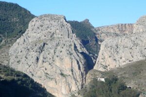
The Gaitanes Gorge, an impressive natural site, it is made up of three distinctive elements: the gorge itself, the imposing Huma mountain range to the east and the majestic Almorchón massif to the west. These geological formations offer a fascinating contrast between the horizontal conglomerates and calcarenites from the Miocene that characterize the Almorchón Massif, and the vertical strata of Jurassic limestone that dominate the Huma mountain range.
The formation of the gorge is a postalpino origin process, where the Guadalhorce River has sculpted a path through the limestones and dolomites that emerged over time. The karst relief of the region presents numerous cavities of great geological and archaeological relevance, suspended over the waters of the river.
The gradients in this area are astonishingly steep. The heights of the peaks that form the gorge reach 300 meters almost vertically, while the width of the canyon is reduced to just 10 meters in some sections. In addition, the natural area exhibits a varied range of altitudes, from 200 meters at the southern limit, where the gorge opens, to the impressive 1,192 meters at the peak of the Huma mountain range.
The flora of the Gaitanes Gorge
The natural area of the Desfiladero de los Gaitanes is a diverse landscape, characterized by varied vegetation that reflects a series of environmental and human influences. Much of the area exhibits a vegetation cover that is in a state of degradation, mainly due to fires and human activities, as well as adverse soil conditions. The pine and juniper forests dominate most of the territory, with reforestation of Aleppo pine being the most common characteristic. These areas are accompanied by xeric scrub that includes species such as esparto grass, rosemary and marjoram. To the southeast, the presence of carob trees is observed in small areas next to these thickets.
In the center of the area, on the limestone rock, is the soft or caudate juniper forest, a unique plant community that reflects a paraclimaxic and relictic character. This juniper forest, with specimens of notable size, represents a unique example in Andalusia and suggests the existence of ancient coastal environments in the region. Furthermore, there are endemic species such as Rupicapnos Africana subsp. decipiens, adapted to calcareous lithosols.
Human influence on vegetation is evident, especially in the presence of eucalyptus trees on the banks of the Guadalhorce River, which have displaced the native riparian forest. This transformation illustrates the dynamics between man and the natural environment in the Gaitanes Gorge, highlighting the importance of the conservation and proper management of this unique landscape.
The fauna in the Gaitanes Gorge
On the heights of the Gorge, mountain goats are the prominent inhabitants, while in the lower areas, close to the water, you can spot smaller animals such as the blackbird or the swift. In addition, mammals such as dormice or genets also make an appearance in this region. In the intermediate areas of the throat, the falcons, kestrels and goshawks They are sighted regularly, along with other medium-sized raptors. At the summit, the majestic eagles and griffon vultures establish their nests, making it a crucial nesting territory for these large birds of prey.
The Guadalhorce River
The Guadalhorce River meanders through the natural space from north to south, labrando su camino a través del paso tallado en las calizas y creando la impresionante garganta que da nombre y carácter a este espacio singular. A lo largo de su recorrido por el desfiladero, una red de arroyos estacionales y ramblas contribuyen al caudal del río, canalizando las aguas procedentes de la sierra de Huma al este, y en menor medida, las del imponente macizo del Almorchón al oeste.
Among the regulation structures that impact the flow of the Guadalhorce, the Guadalhorce-Guadalteba reservoir system stands out, composed of three dams strategically located at the confluence of this river with its tributaries, the Guadalteba and the Turón. These reservoirs are located near the northern limit of the Desfiladero de los Gaitanes natural area. Downstream, within the protected area, the course of the river is seen again interrupted by the Gaitanejo reservoir, just before the torrent rushes into the beginning of the pit. This intricate network of hydraulic regulation not only influences the flow of the river, but also plays a crucial role in water management throughout the region, as well as in the conservation of the unique ecosystem that characterizes this extraordinary natural site.


